US Publishes First Map Showing Golan as Israeli Territory
Stand for Israel | April 17, 2019
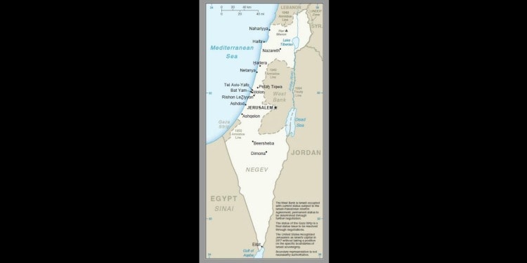
Three weeks ago, the Trump administration recognized the Golan Heights as being under Israeli sovereignty, a move that many who stand against Israel decried. And now, The Times of Israel reports, the U.S. has published its first map showing the Golan as Israeli territory:
US Mideast envoy Jason Greenblatt tweeted a picture of the map on Tuesday, saying: “Welcome to the newest addition of our international maps system.”
The map shows the 1974 ceasefire line between Israel and Syria as a permanent border, whereas the border with Lebanon continues to be demarcated as the 1949 armistice line.
The map also notes that the West Bank is Israeli-occupied, with its final status to be determined in peace talks.
And it notes that while the US recognized Jerusalem as Israel’s capital in 2017, it does not take a position on the boundaries of the holy city, which is also claimed by the Palestinians as the capital of a future state.
However, while the map was updated, text attached to the Israel entry in the latest CIA world factbook, which included the map, continued to call East Jerusalem and the Golan Heights “Israeli occupied…”